
Posted on: 10 March 2020
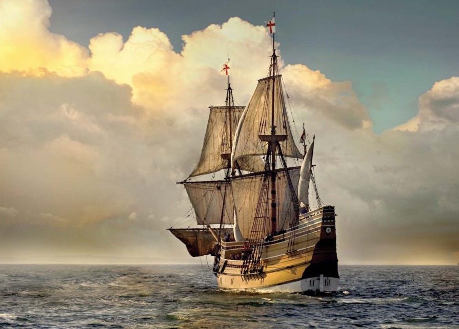
Four hundred years ago, 101 Pilgrims and their crew sailed from Plymouth England to the New World on Mayflower (pictured), the journey took two months to make the transatlantic crossing.
It’s a journey that will be replicated by the modern day Mayflower, an unmanned autonomous ship powered by AI. It’s hoped that the 2020 Mayflower will complete the voyage in less than two weeks, performing vital research along the way.
In this article, two experts – Solis Marine Founding Partner Captain John Simpson and Naval Architect Dr Rachel Nicholls-Lee – ponder the challenges of 1620 with those in 2020.
In 1620, navigation was rudimentary with ships only able to establish their latitude north or south, writes Solis Marine founding partner Captain John Simpson.
It was not possible to calculate how far east or west the vessel had travelled. That could not be determined effectively until Harrison constructed the first accurate time piece/chronometer in the 18th century.
To find a port/location, mariners would calculate the latitude and simply sail until finding land on that latitude. Charts of the ocean and the coast were still to be created. Even the coast and ports of the UK were not surveyed for mariners until the late 17th century (source: Greenville Collins).
The sailing vessels of the time were also limited by wind direction and force. Mayflower could not sail even part into the wind due to the limitations of the sail angle which meant that they effectively zig zagged their way across the ocean, particularly when crossing to the New World as the wind generally blows from the west and against progress being made.
Relying on wind power extends the length of the voyage and varying speeds/calms mean that it is difficult to estimate when a landfall might be made.
A simple magnetic compass to confirm direction and a basic instrument to establish latitude was the limitation of available technology. A log, basically a small piece of wood attached to a knotted rope, was thrown overboard and the knots counted as they passed through the operator’s hand to establish the speed in knots to assist in estimating the distance travelled.
Weather forecasting was rudimentary and based on folklore and experience of previous conditions. Predicting storms was possible, but not their accurate arrival, strength or direction.
Water and food preservation was critical, particularly when voyages became extended. Not an issue for modern vessels, and of course, not for an autonomous vessel.
This contrasts with the accurate gyro and satellite compasses available today. Precise positioning and electronic charts (ECDIS) gives real time progress reporting that has only been possible since the arrival of accurate GPS in the late 20th century. Satellite weather forecasting allows vessels to route themselves through areas where the conditions are as advantageous as possible, whether in scale or direction.
One advantage for Mayflower was that meeting another vessel was unlikely, with the risk of collision reduced to that of meeting a whale.
Rules and regulations for the conduct of vessels when meeting each other was not established until the 19th century (COLREGS).
These rules determine what vessels have to do to detect other vessels, determine whether there is a risk of collision and then what to do if there is risk of collision. They only deal with two vessels approaching each other and not multi vessel scenarios.
The Rules are prescriptive but do allow mariners to use their initiative in some circumstances.
Complying with the COLREGS will be a difficult task for the autonomous vessel programmers. The COLREGS apply to all vessels on the high seas and all waters connected there with (Rule 1). There is no distinction between manned and unmanned vessels.
The 2020 Mayflower Autonomous Ship, or MAS, is designed by naval architect Dr Rachel Nicholls-Lee working with project lead Brett Phaneuf, one of the founders of ProMare, a non-profit charity set up to promote marine exploration around the world.
Follow this link to read the article in full.

